Active Kilitop and Safaris

'
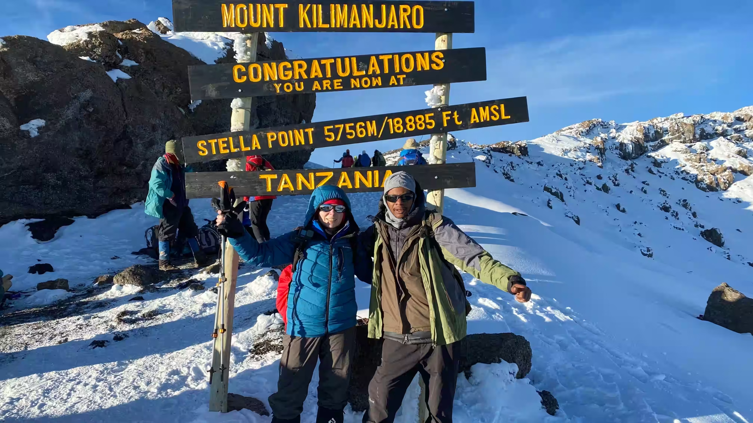
Climbers at the summit sign on Kilimanjaro
Home/Kilimanjaro/Rongai Route
Kilimanjaro · 7 days · Rongai Route · Private climb

Rongai Route

The only route that starts on the northern side, close to the Kenyan border: drier, quieter and gentler than the south, with a night under Mawenzi, and down the Marangu path so you see both sides of the mountain.

MoshiRongai GateMawenzi TarnKibo HutsUhuru PeakMarangu Gate
Length7 days · 6 nights on the mountain
SummitUhuru Peak, about 5,895 m
Starts & endsRongai Gate (north) / Marangu Gate (south-east)
SleepingTented camps
Best monthsJanuary–February, June–October
IOverview

The quiet side of the mountain, and down the other.

Rongai is the only route that starts on the northern side of Kilimanjaro, a long drive round the mountain from Moshi, close to the Kenyan border. That side is usually drier than the south, far fewer people climb it, and the gradients are the gentlest on the mountain. You camp in tents every night, spend a night beside the small lake under the towers of Mawenzi, and cross the saddle to Kibo Huts for summit night.

You come down by the Marangu route on the south-east side, so you see the mountain from two directions. The trade-offs are honest ones: the northern landscape is plainer than the western routes’ — less forest, fewer big views on the lower days — the drive to the start takes most of a morning, and the acclimatisation, while better than Marangu’s, is not as generous as Lemosho’s.

Major attractions · 4
  1. 01Kilimanjaro National Park
  2. 02Uhuru Peak
  3. 03Mawenzi Tarn
  4. 04The saddle between Mawenzi and Kibo
Trip detailsPrivate climb
Length
7 days · 6 nights on the mountain
Route
Rongai up, Marangu down
Start / end
Rongai Gate, about 2,360 m / Marangu Gate, about 1,880 m
Sleeping
Tents
Summit
Uhuru Peak, about 5,895 m
Group size
Maximum per group
Meals
Full board on the mountain
Best period
Jan–Feb · Jun–Oct
Fitness
Good walking fitness; gentle gradients, but a very long summit day
Request a free quote →Questions? WhatsApp +255 762 914 714
IIThe route

Up from the north, across the saddle, down the south-east.

Seven mountain days and six nights in tents. A long road transfer round the mountain to the start; about an hour back to Moshi from the finish. The solid line is this plan; the dotted lines are the other roads through the region. Point at a day to see its leg.

Route map: The Rongai Route: Rongai Gate to Simba Camp, Second Cave, Kikelewa, Mawenzi Tarn, Kibo Huts and Uhuru Peak, then down to Horombo and Marangu Gate Kibo N Uhuru Peak Mandara Huts Horombo Huts Kibo Huts Simba Camp Second Cave Kikelewa Mawenzi Tarn Marangu Gate Rongai Gate
Drawn to scale

Every metre up, and every metre down.

Rongai climbs gently and steadily round the north-east of the mountain, with a short day up to Mawenzi Tarn that leaves the afternoon free for a walk higher. It gives more time to adjust than Marangu, though less than Lemosho, and comes down fast on the Marangu side.

Elevation profile: Rongai Route 2,000 3,000 4,000 5,000 6,000 Day 1 Day 2 Day 3 Day 4 Day 5 Day 6 Day 7 Rongai Gate Simba Camp Second Cave Kikelewa Mawenzi Tarn Kibo Huts Uhuru Peak Horombo Mandara Huts Marangu Gate Metres above sea level. Altitudes rounded; published figures for some camps differ by up to about 100 m.
IIIDay by day

Seven days, one at a time.

Each day lands on top of the last as you scroll: honest road time, game time, meals and where you sleep. Times are door to door in a safari vehicle and move with the season and what you stop for.

The path above Rongai Gate climbing gently through farmland and forest on Kilimanjaro's northern slopes — 1600×1200
Simba CampADD IMAGE · The path above Rongai Gate climbing gently through farmland and forest on Kilimanjaro’s northern slopes
01/ 07

Roughly 3 to 4 hours by road round the mountain, then about 3½ hours on foot.

02°59′S 37°27′EDay 1 · Moshi → Rongai Gate → Simba Camp

Round the mountain to Rongai Gate, and up to Simba Camp

Travel
~3½ h walking + ~3½ h road
Highest point
Simba Camp, about 2,670 m
Meals
L · D
Sleep
Tented camp, about 2,670 m
  1. Morning

    A long drive east and then north round the mountain towards the Kenyan border, roughly 3 to 4 hours depending on the road. Registration at Rongai Gate, at about 2,360 m, while the porters weigh and load.

  2. Afternoon

    A gentle path through farmland and a band of forest, then out onto the lower moorland. The gain today is small — about 300 m — which is a good start.

  3. Evening

    Simba Camp, at about 2,670 m. The first night in a tent; your crew will have the camp up before you arrive.

Why the drive is worth it

The long road in is the price of starting on the quiet side. From here to the saddle you will see far fewer groups than on the southern routes.

Open heather moorland on the northern slopes of Kilimanjaro, Kibo's snowfields ahead — 1600×1200
Second CaveADD IMAGE · Open heather moorland on the northern slopes of Kilimanjaro, Kibo’s snowfields ahead
02/ 07

About 4 hours up open moorland, with Kibo ahead of you.

03°01′S 37°25′EDay 2 · Simba Camp → Second Cave

Up to Second Cave

Travel
~4 h walking
Highest point
Second Cave, about 3,450 m
Meals
B · L · D
Sleep
Tented camp, about 3,450 m
  1. Morning

    A steady climb through heather and open moorland. On a clear morning the dome of Kibo is ahead of you and the plains of Kenya behind.

  2. Midday

    Lunch at Second Cave, a lava overhang at about 3,450 m.

  3. Afternoon

    Rest and drink. Short, slow walks around camp help more than lying in the tent.

Kikelewa camp in a sheltered valley below Mawenzi, giant groundsels around the tents — 1600×1200
KikelewaADD IMAGE · Kikelewa camp in a sheltered valley below Mawenzi, giant groundsels around the tents
03/ 07

About 4 hours, turning east towards Mawenzi, gaining only a little height.

03°03′S 37°27′EDay 3 · Second Cave → Kikelewa

Across to Kikelewa

Travel
~4 h walking
Highest point
Kikelewa, about 3,600 m
Meals
B · L · D
Sleep
Tented camp, about 3,600 m
  1. Morning

    The path leaves the direct line to Kibo and turns east across the moorland towards the jagged peak of Mawenzi.

  2. Afternoon

    Kikelewa, at about 3,600 m, in a sheltered valley with giant groundsels. A small gain today, and that is deliberate: the body is adjusting.

  3. Evening

    Your guide checks how everyone is feeling, as every evening. Say if you have a headache, however mild.

Mawenzi Tarn, a small lake at the foot of Mawenzi's rock towers, tents on its shore — 1600×1200
Mawenzi TarnADD IMAGE · Mawenzi Tarn, a small lake at the foot of Mawenzi’s rock towers, tents on its shore
04/ 07

A short, steep climb of about 3½ hours to a small lake under Mawenzi.

03°05′S 37°27′EDay 4 · Kikelewa → Mawenzi Tarn

Up to Mawenzi Tarn

Travel
~3½ h walking
Highest point
Mawenzi Tarn, about 4,315 m
Meals
B · L · D
Sleep
Tented camp, about 4,315 m
  1. Morning

    A steep pull up grassy slopes into the alpine desert, arriving by lunchtime.

  2. Afternoon

    Mawenzi Tarn, at about 4,315 m, beneath the towers of Mawenzi. Usually a slow acclimatisation walk a little higher on the ridges above camp, then back down to sleep.

  3. Evening

    One of the most striking camps on the mountain, and cold once the sun drops behind the ridge.

Climb high, sleep low

The afternoon walk above camp, even a short one, is worth doing if your guide suggests it. It is exactly what helps the body adjust.

The bare stony saddle between Mawenzi and Kibo, a line of walkers crossing towards Kibo Huts — 1600×1200
Kibo HutsADD IMAGE · The bare stony saddle between Mawenzi and Kibo, a line of walkers crossing towards Kibo Huts
05/ 07

About 5 to 6 hours across the high desert of the saddle to the foot of the summit cone.

03°05′S 37°23′EDay 5 · Mawenzi Tarn → Kibo Huts

Across the saddle to Kibo Huts

Travel
~5½ h walking
Highest point
Kibo Huts, about 4,710 m
Meals
B · L · D
Sleep
Tented camp, about 4,710 m
  1. Morning

    Across the saddle, the wide stony desert between Mawenzi and Kibo. It is exposed and often windy; the summit cone grows slowly in front of you.

  2. Afternoon

    Kibo Huts, at about 4,710 m, where the Rongai and Marangu routes meet. Rongai groups camp in tents here. An early dinner and the summit briefing.

  3. Evening

    Kit laid out, water bottles inside the sleeping bag, and sleep from about seven if you can.

Sunrise over Mawenzi seen from Kibo's crater rim, climbers silhouetted on the path to Uhuru Peak — 1600×1200
HoromboADD IMAGE · Sunrise over Mawenzi seen from Kibo’s crater rim, climbers silhouetted on the path to Uhuru Peak
The long day06/ 07

The long one: roughly 12 to 14 hours of walking, most of the ascent in the dark.

03°08′S 37°26′EDay 6 · Kibo Huts → Uhuru Peak → Horombo

Summit night: Uhuru Peak, and down to Horombo

Travel
~13 h walking
Highest point
Uhuru Peak, about 5,895 m
Meals
Snacks · B · L · D
Sleep
Tented camp, about 3,720 m
  1. Around midnight

    Woken with tea, and out in the dark up the scree of the summit cone towards Gilman’s Point on the crater rim. Slow, steady and below freezing near the top.

  2. Dawn

    Along the crater rim to Uhuru Peak, at about 5,895 m, usually as the sun comes up behind Mawenzi. A few minutes at the top, then down.

  3. Afternoon

    Down to Kibo Huts to rest and eat, then on across the saddle to Horombo, at about 3,720 m, on the Marangu side.

Turning back

Your guide will turn anyone round whose symptoms are worsening. The summit is optional; getting down is not. Nobody is ever sent down alone.

The forest path near Mandara Huts on the descent to Marangu Gate — 1600×1200
MoshiADD IMAGE · The forest path near Mandara Huts on the descent to Marangu Gate
07/ 07

About 6 hours down through moorland and forest, then about an hour to Moshi.

03°21′S 37°21′EDay 7 · Horombo → Marangu Gate → Moshi

Down to Marangu Gate

Travel
~6 h walking + ~1 h road
Highest point
Horombo, about 3,720 m
Meals
B · L
Sleep
Homeward
  1. Morning

    Down the Marangu path through the moorland, past Mandara Huts and into the forest — the southern side of the mountain, greener and wetter than where you started.

  2. Midday

    Marangu Gate, at about 1,880 m, where you sign out and collect your summit certificate. This is where the crew is thanked and tipped.

  3. Afternoon

    About an hour back to your hotel in Moshi.

Both sides

Starting in the north and finishing in the south-east means you have crossed the mountain. Your transport is waiting at the other gate; nothing to arrange.

IVRates

Priced by group size, because the vehicle is shared.

Park fees, accommodation, vehicle, guide and meals as listed — per person, no booking fees. Rates move with the month and lodge availability; your quote is fixed once you book.

Private climb · price per person, sharing
Group size1 person2 people3 people4 people5 people6 people
From yearraterateraterateraterate
Single supplementamount
Children

Child policy: ages, sharing discount, lodge minimum ages

What moves the price

What changes itHow much
  • Days on the mountain

    Park fees are charged per person per day, so each extra day adds its own fees as well as crew wages.

  • How many climb together

    The guide and much of the crew cost the same for two climbers or six, so the per-person price falls as the group grows.

  • The standard of camp

    A private toilet tent, a larger mess tent or more space in the tents each add porters.

  • The transfer to the start

    Rongai Gate is a long drive round the mountain, longer than to the southern gates.

  • Hotel nights either side

    The nights in Moshi or Arusha before and after are added at the level you choose.

Not sure which level suits you? Tell us your dates, group and budget and we will send an itemised quote with named properties.

Request a free quote →
On request
On request
VWhere you sleep

Six camps in six nights, one of them beside a tarn.

Each night is described by type first, because the right camp depends on your month. The properties we normally use at each level are listed below; your quote confirms them against availability.

Night 11×

Simba Camp

Tented camp, about 2,670 m

A short first day, so the first night is low and easy.

Private climb here means
What our standard camp is (tent type, sleeping mat, mess tent, private toilet tent)
Step up
Ask us
Night 21×

Second Cave

Tented camp, about 3,450 m

The first night on the open moorland.

Private climb here means
What our standard camp is (tent type, sleeping mat, mess tent, private toilet tent)
Step up
Ask us
Night 31×

Kikelewa

Tented camp, about 3,600 m

A sheltered valley, and a deliberately small gain in height.

Private climb here means
What our standard camp is (tent type, sleeping mat, mess tent, private toilet tent)
Step up
Ask us
Night 41×

Mawenzi Tarn

Tented camp, about 4,315 m

A lake under Mawenzi’s towers, with a free afternoon to walk higher.

Private climb here means
What our standard camp is (tent type, sleeping mat, mess tent, private toilet tent)
Step up
Ask us
Night 51×

Kibo Huts

Tented camp, about 4,710 m

The high camp at the foot of the summit cone. A few hours’ rest before summit night.

Private climb here means
What our standard camp is (tent type, sleeping mat, mess tent, private toilet tent)
Step up
Ask us
Night 61×

Horombo

Tented camp, about 3,720 m

The night after the summit, on the Marangu side, a long way below Kibo.

Private climb here means
What our standard camp is (tent type, sleeping mat, mess tent, private toilet tent)
Step up
Ask us

The properties we use

WherePrivate climb
Simba Campproperty
Second Caveproperty
Kikelewaproperty
Mawenzi Tarnproperty
Kibo Hutsproperty
Horomboproperty

What ‘private climb’ means on this trip

  • Tents. Your crew carries, pitches and strikes the camp every day. Tent type and how many share
  • Mess tent. Meals at a table, out of the wind. Confirm a mess tent with table and chairs is standard
  • Toilet. The camps have park long-drops. Whether a private toilet tent is standard or an extra
  • Food and water. Three cooked meals a day and treated drinking water. Tell us about diets early; supplies are bought before the climb.
VIThe fine print

What is in the price, and what isn’t.

✓Included

  • Park feesConservation, camping or hut, and rescue fees — each itemised on your quote
  • A licensed lead guidePlus assistant guides in proportion to the group
  • Cook and portersCarrying the camp, the food and your main bag within the park’s weight limit
  • Meals on the mountainThree meals a day and treated drinking water
  • Transfers to and from the gateFrom your hotel in Moshi or Arusha

–Not included

  • International flights
  • Hotel nights before and afterAdded to the quote at the level you choose
  • Tanzanian visaApply online before you travel
  • Travel insuranceRequired. It must cover trekking to 6,000 m and evacuation
  • Tips for the crewThe largest cost people forget; we send a guideline with your booking
  • Kit hireSleeping bag, poles, jacket — available in Moshi if you do not bring your own
VIIAdd-ons & changes

The plan is a starting point, not a package.

The changes people ask for most, each with what it costs you in days or hours. Not in the standard price — arranged on request, and most can be combined.

+1 dayprice

An extra night at Mawenzi Tarn

Stay a second night under Mawenzi with a walk higher in between. The most useful day you can add to this route.

Makes senseAnyone who has not been to altitude before
Compare the routes →
+1 dayprice

Lemosho instead

Eight days from the west, with the most time to acclimatise of the routes we run and the best scenery on the lower days. Busier from Barranco onwards.

Makes senseAcclimatisation matters more than quiet
The Lemosho Route →
−1 dayprice

Marangu, in huts

Six days up and down the south-east side, sleeping in shared huts rather than tents. Shorter, with less time to acclimatise.

Makes senseYou would rather have a roof than a tent
The Marangu Route →
Half dayprice

Chemka Hot Springs after the climb

Warm, clear spring water under fig trees, about an hour from Moshi. The obvious thing for tired legs.

Makes senseThe day after you come down
Chemka Hot Springs →
+3 daysprice

A safari after the climb

Tarangire and the Ngorongoro Crater from Arusha, with nothing to carry.

Makes senseYou have come this far
Northern Circuit Express →
Backgroundprice

Kilimanjaro, the mountain

The zones, the seasons and how the routes compare, on one page.

Makes senseStill choosing
Kilimanjaro →
VIIIWhen to go

Rated for this route, not for the country.

The dry months, January to early March and June to October, are the best on every route. The northern side of Kilimanjaro usually gets less rain than the south, so Rongai is often the route we suggest when someone can only come in a wetter month — though in the long rains of April and May no side of the mountain is dry.

Jan
Dry, clear, cold nights
Feb
Dry, warmer
Mar
Rains building
Apr
Long rains, wet trails
May
Long rains
Jun
Dry, cold, quieter
Jul
Dry, cold, busy
Aug
Dry, busy
Sep
Dry, clear
Oct
Dry, warmer
Nov
Short rains
Dec
Holiday weeks busy
Three bars — the route at its bestTwo — good, with trade-offsOne — possible, and quiet
IXFlights & extras

Getting there.

Arrive

Kilimanjaro International (JRO)

Between Moshi and Arusha, and the closest international airport to the mountain. Plan to land at least a day before the climb: the briefing and the kit check happen the evening before.

Stay before and after

Moshi or Arusha

A night before the climb and a night after are not part of the days shown here; we add them to your quote at the hotel level you choose.

Leave a spare day

Weather and bodies

Nothing is scheduled around the summit day, but a day in hand before an international flight takes the pressure off everyone.

What else to budget.

Not part of the safari price, in order of how much they matter.

  • Crew tipsGuides, cook and porters, at the end of the climb
    Guideline per day
  • Kit hireSleeping bag, poles, warm jacket, in Moshi
    Typical cost
  • Tanzanian visaApply online before travel
    Current fee
  • Travel insuranceMust cover trekking to 6,000 m and evacuation
    Typical cost
  • Personal spendingSnacks, souvenirs, a drink at the gate
    Varies
XWhy book with us

Only what we can prove.

01

Arusha, since 2010

A Tanzanian company, locally owned, running climbs and safaris for more than fifteen years.

02

Licensed and registered

TALA-licensed through the Tanzania Tourist Board and registered with BRELA. Ask us for the numbers; we will send them.

03

One lead guide, one crew

The same lead guide, assistant guides, cook and porters from the gate to the gate. Nobody else joins your group.

04

Every fee on its own line

Conservation, camping or hut, and rescue fees are shown separately on your quote, so you can see exactly what goes to the park.

XIQuestions

The ones we are asked most.

It is the quietest of the main routes, usually the driest, and the gentlest in gradient. It gives more time to acclimatise than Marangu but less than Lemosho. The lower days are plainer to look at than the western routes, and the drive to the start is long.

You leave Kibo Huts usually around midnight and climb in the dark to Gilman’s Point on the crater rim, then along the rim to Uhuru Peak around dawn, and then all the way down to Horombo. It is cold, slow and the hardest day most people have ever walked.

Acute mountain sickness can affect anyone, however fit. Your guide checks everyone each evening and on the way up. If symptoms get worse, the answer is to go down, and we will. Whether to take medication such as acetazolamide is a decision for your own doctor. Oxygen and first-aid kit carried: ask us.

Usually. The northern side lies in the mountain’s rain shadow and gets less rain than the south. It is not a guarantee, and in the long rains of April and May no route is dry.

Tips for the crew are the cost people most often forget; we send a guideline with your booking. Sleeping bags, poles and warm jackets can be hired in Moshi if you do not want to bring your own.

Fit enough to walk four to six hours a day for several days running, and then much longer on summit night. Walks with a pack and long hill days in the months before help most. Fitness does not protect you from altitude, but it makes every other day easier.

Begin here

Send us your dates. We will send you the real version.

Named camps, the right direction of travel for your month, every fee on its own line — and a straight answer if another plan would suit you better.

Rather talk it through?WhatsApp us+255 762 914 714
Safari request Rongai Route 7 days · 6 nights · private climb
01When, and what for?
How fixed are the dates?
What do you want from it? Pick any
02Who’s coming?
Travelling as
03How you like it
Style of camp

Not a commitment. It lets us send something realistic instead of something you have to reject.

04Where to reach you
We need a name to write back to.
That email address does not look complete.
Step 1 of 4
Loading itinerary…
Saved Trips